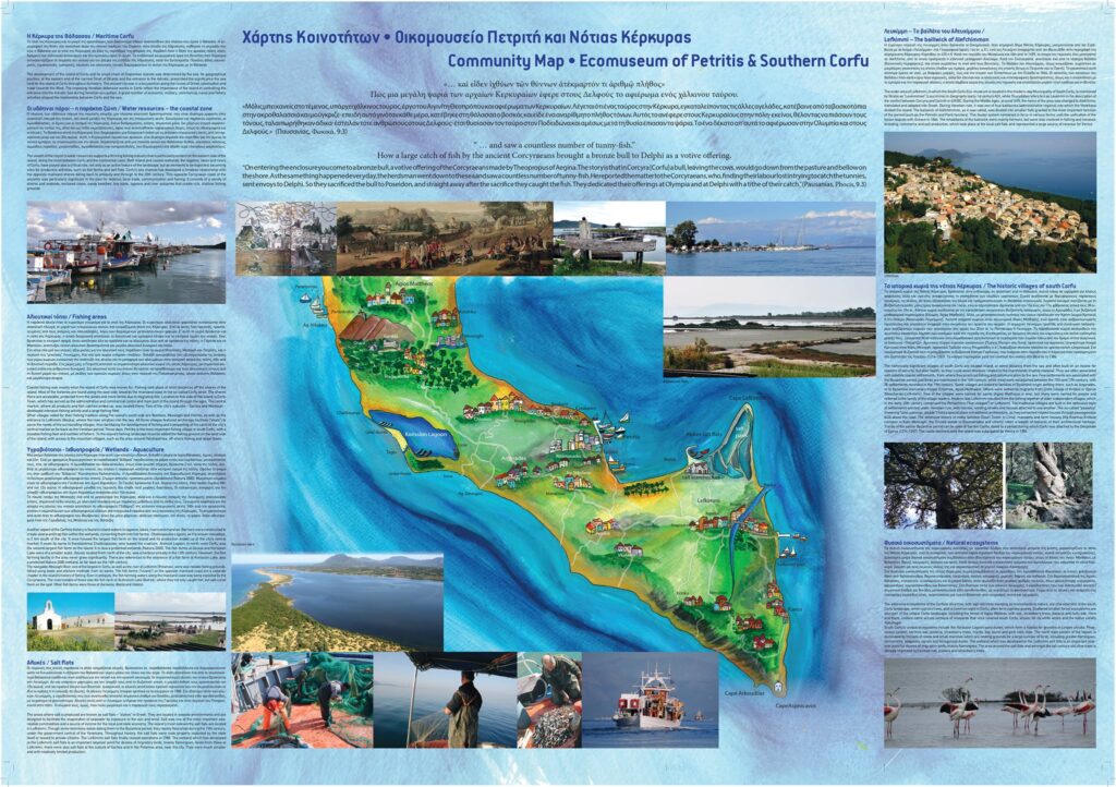
The Community Map is a tool with which the inhabitants of a specific place have the opportunity to represent the heritage, the landscape, the knowledge in which they recognize themselves and which they wish to pass on to new generations. It highlights the way in which the local community sees, perceives, attributes value to its territory, its memories, its transformations, its current reality and how it would like it to be in the future. It consists of a cartographic representation or any other product or elaborate in which the community can identify.
In this way, a “new” concept of territory is made explicit, which is not only the place where one lives and works, but which also preserves the history of the men who inhabited and transformed it in the past, the signs that characterized it. There is the awareness that the territory, whatever it may be, contains a widespread heritage, rich in details and above all a dense network of relationships and interrelationships among the many elements that distinguish it.
The map is a cultural process through which a community draws the contours of its heritage; it is more than a simple inventory of tangible or intangible assets, as it includes a set of invisible relationships between these elements and so it must be built with the help of the residents and bring out these relationships.
The community map of Petritis Ecomuseum was created by the Ionian University Department of History in collaboration with the Ephorate of Antiquities of Corfu and the Petriti Fishermen’s Association in the frame of FISH&CHIPS project.